Home / Environment / Florida Rain Soaks State as Tropical Disturbance Weakens
Florida Rain Soaks State as Tropical Disturbance Weakens
21 Nov
Summary
- A non-tropical low pressure area east of Florida shows little chance of formation.
- Florida experienced record rainfall and flash floods, with cleanup efforts ongoing.
- The Atlantic hurricane season officially concludes on November 30.
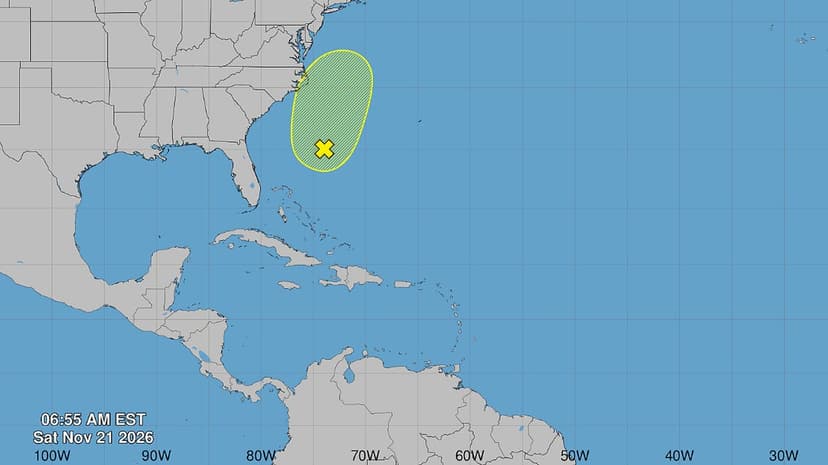
Florida is experiencing residual effects from heavy rainfall and flash floods, with cleanup operations underway in some areas. Meanwhile, a large non-tropical low-pressure system is situated a few hundred miles east of northeastern Florida, producing disorganized showers and thunderstorms.
Experts from the National Hurricane Center have assessed that there is a low chance of significant tropical or subtropical development from this system, with formation probabilities remaining at 10% through both 48 hours and 7 days. This system is still expected to bring gusty winds, dangerous surf, rip currents, and coastal flooding to parts of the southeast and mid-Atlantic U.S. coasts.
In addition to this offshore system, another low is centered near Tampa, and a cold front is affecting the Northwest Gulf, leading to cooler temperatures. The 2026 Atlantic hurricane season officially concludes on November 30, though Florida may still see some rain before then.
Earlier in the season, Hurricane Isaias made landfall in Destin, Florida, as a Category 2 storm, causing two fatalities. Another storm, Josephine, briefly formed as a subtropical storm. The list of potential storm names for the 2026 season includes Kyle as the next designation.


