Home / Environment / Florida Sees Rare, Drooping Mammatus Clouds
Florida Sees Rare, Drooping Mammatus Clouds
24 Jun
Summary
- Mammatus clouds are rare, lumpy formations appearing under storm anvils.
- They form from sinking cold air, unlike typical rising warm air clouds.
- These unusual clouds signal potential turbulence for pilots but not tornadoes.
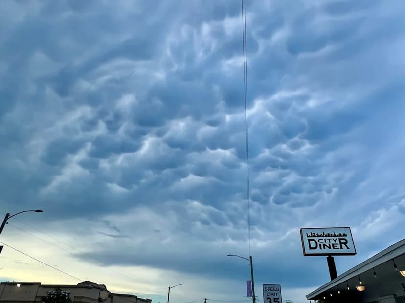
This week, Florida experienced a display of unusual mammatus clouds, characterized by their drooping, grape-like bulges, forming over West Palm Beach on Monday, June 22. These rare formations, derived from the Latin word for 'udder,' develop in a reverse process to most clouds, originating from sinking cold air rather than rising warm air.
Mammatus clouds typically appear along the downwind edge of a storm's anvil. Meteorologists explain that strong upper winds can push the anvil, allowing these distinctive pouches to form on the underside. While they can appear with various cloud types, they are most commonly associated with strong thunderstorms.
Despite their sometimes ominous appearance, mammatus clouds do not signal imminent tornadoes or hail. Instead, they can serve as a warning for pilots, indicating sinking air and potential turbulence in the vicinity. Florida's climate is conducive to frequent summer thunderstorms due to rising temperatures and colliding sea breezes, but the specific conditions required for mammatus cloud formation make them a less common sight.