feedzop-word-mark-logo
searchLogin
Feedzop
homeFor YouIndiaIndia
You
bookmarksYour BookmarkshashtagYour Topics
Trending
trending

IBPS SO Prelims Result Declared

trending

SpiceJet launches Iraq flights

trending

Sensex Nifty hit high

trending

Nimisha Priya execution stayed

trending

NEERI approved green crackers

trending

MCC NEET PG Counselling Schedule

trending

Reliance Industries Q2 results up

trending

OnePlus 15 launch date announced

trending

DAX index gains 0.38%

Terms of UsePrivacy PolicyAboutJobsPartner With Us

© 2025 Advergame Technologies Pvt. Ltd. ("ATPL"). Gamezop ® & Quizzop ® are registered trademarks of ATPL.

Gamezop is a plug-and-play gaming platform that any app or website can integrate to bring casual gaming for its users. Gamezop also operates Quizzop, a quizzing platform, that digital products can add as a trivia section.

Over 5,000 products from more than 70 countries have integrated Gamezop and Quizzop. These include Amazon, Samsung Internet, Snap, Tata Play, AccuWeather, Paytm, Gulf News, and Branch.

Games and trivia increase user engagement significantly within all kinds of apps and websites, besides opening a new stream of advertising revenue. Gamezop and Quizzop take 30 minutes to integrate and can be used for free: both by the products integrating them and end users

Increase ad revenue and engagement on your app / website with games, quizzes, astrology, and cricket content. Visit: business.gamezop.com

Property Code: 5571

Home / Environment / Coastal Mapping Empowers Maine's Climate Resilience Efforts

Coastal Mapping Empowers Maine's Climate Resilience Efforts

10 Oct

•

Summary

  • New high-definition map of Maine's coastline released
  • Map identifies best areas to fortify against sea-level rise
  • Funded by federal grants, despite recent cuts to climate research
Coastal Mapping Empowers Maine's Climate Resilience Efforts

In August 2025, a New England remote sensing company, Nearview, released a new high-definition map of Maine's 3,500-mile coastline. The map, called the Coastal Ecosystem Map Application Platform (CEMAP), aims to help local officials, regulators, and seaweed harvesters plan for climate change and manage the state's coastal resources.

The platform was developed over several years, with initial funding from the National Oceanic and Atmospheric Administration. Despite recent cuts to federal climate change research under the Trump administration, Nearview was able to complete the project and make the data publicly available.

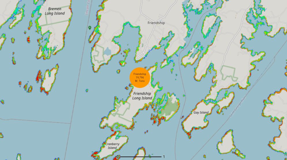
CEMAP includes five different maps, each providing unique insights. One map identifies the best stretches of coastline for dune stabilization and other climate resilience projects. Other maps detail the location and density of aquatic vegetation, such as wild seaweed forests, which could inform sustainable harvesting practices.

The data behind CEMAP comes from meticulous fieldwork, including drone flights and analysis of satellite imagery. Nearview collaborated with several Maine-based organizations, including the Maritime Academy, Schoodic Institute, and the University of Vermont, to gather and interpret the data.

For Nearview's founder, Stefan Claesson, the goal is to empower local officials, researchers, and businesses with the information they need to adapt to the impacts of climate change. "Maps are powerful that way," he said. "They change people's perspective and allow them to see the coastal environment in a new way."

Disclaimer: This story has been auto-aggregated and auto-summarised by a computer program. This story has not been edited or created by the Feedzop team.
CEMAP is a new online platform that provides detailed mapping of Maine's coastline, including information on areas suitable for climate resilience projects and the location of underwater seaweed forests.
Nearview used drones, multispectral cameras, and satellite imagery to gather detailed information about Maine's coastal environment. They collaborated with several Maine-based organizations to analyze the data and create the maps.
CEMAP will provide local officials, regulators, and businesses with valuable data to help them plan for the impacts of climate change, such as sea-level rise, and manage coastal resources like seaweed harvesting in a sustainable way.

Read more news on

Environmentside-arrowNational Oceanic and Atmospheric Administrationside-arrow

Advertisement

Advertisement

Advertisement

You may also like

Tree Swallows Near U.S. Military Bases Carry Alarming Levels of Toxic 'Forever Chemicals'

1 day ago • 7 reads

article image

Hacker Sentenced to 4 Years for Stealing Data of 60M Students, 10M Teachers

14 Oct • 17 reads

article image

Virginia Tackles Surging Energy Demands and Decarbonization Goals

10 Oct • 31 reads

article image

Massive Undersea Aquifer Offers New Hope for Water Scarcity

5 Oct • 102 reads

Clam Shells Expose Instability in Critical Atlantic Ocean Current

5 Oct • 65 reads

article image