Home / Disasters and Accidents / Welney Wash Road Floods: Highest Levels This Year
Welney Wash Road Floods: Highest Levels This Year
16 Feb
Summary
- The A1101 Welney Wash Road is closed due to record flood levels.
- Water reached 2.8m high, the highest since December 14, 2024.
- Drivers are warned to avoid the area and find alternative routes.
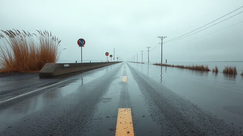
The A1101 Welney Wash Road, situated on the Norfolk-Cambridgeshire border, is currently closed due to exceptionally high floodwaters. Water levels have surged to 2.8 meters (9ft 2in), marking the highest point recorded this year as of 08:00 GMT today, February 16, 2026. This is the highest level observed since December 14, 2024.
Local resident Ken Goodger, co-founder of Welney Flood Watch, urged drivers to avoid the route, emphasizing the risk of costly detours and potential vehicle damage. While not as severe as the December 2024 flood, the situation could worsen if rainfall persists. A flood barrier was installed near Welney village in 2022 by the Environment Agency to protect residents from reservoir overflow.
Motorists have a history of getting stuck on the flooded road, even with existing closure signs and warnings. Local farmers with tractors have assisted in rescues, but these services incur costs. Goodger established Welney Flood Watch in 2020 to disseminate timely information and prevent drivers from entering the water, thereby reducing unnecessary emergency service interventions.